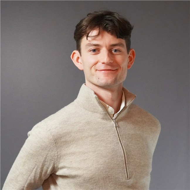
Research Scientist
Theodor Johannes Line Forgaard
- Department Image analysis, machine learning and Earth observation
- Phone number +47 22 85 25 83
- E-mail tforgaard@nr.stage.dekodes.no
Publications
- 14 publications found
Løland, Anders; Forgaard, Theodor Johannes Line og Salberg, Arnt Børre. (2026).
THOR: Den nye, norske KI-modellen som kan endre hvordan vi overvåker jorda.
NVA
MediaPodcast
Waldeland, Anders U.; Forgaard, Theodor Johannes Line; Ordonez, Alba; Wade, David og Bugge, Aina Juell. (2025).
Training an AI-model on all seismic data in DISKOS: The seismic foundation model for NCS. Geo publishing
NVA
Vitenskapelig foredrag
Salberg, Arnt Børre; Jensen, Are Charles; Reksten, Jarle Hamar; Molværsmyr, Sindre; Gundersen, Hege; Kvile, Kristina Øie; Biuw, Martin; Forgaard, Theodor Johannes Line og Hancke, Kasper. (2025).
SeaBee Data Analysis Products.
Vis sammendrag
This report details the data analysis products developed within the SeaBee project, a national infrastructure for drone-based services for use in coastal and aquatic research, mapping and monitoring of habitats, animal communities, and anthropogenic impacts. We present an advanced, automated data analysis pipeline that leverages deep learning for two primary tasks: pixel-wise thematic mapping of coastal habitats and object detection for counting wildlife. The pipeline utilizes models such as U-Net and Faster R-CNN to process high-resolution drone imagery (RGB, MSI, and HSI) and incorporates a novel hierarchical classification structure for habitat mapping and a robust method for detecting out-of-distribution (OOD) samples.
We demonstrate the pipeline's pixel-wise mapping effectiveness through extensive experiments at three diverse Norwegian coastal sites—Remøy, Vega, and Ølbergholmen—achieving high accuracy in mapping complex habitats like kelp forests and various substrate types. Furthermore, the object detection framework shows strong performance in the automated counting and classification of 11 seabird species and coastal seals, offering a significant improvement in efficiency over traditional survey methods. The results confirm that the SeaBee pipeline is a powerful, scalable tool for environmental research and management, though we also discuss challenges such as data imbalance and model generalizability that will inform future work.
This research is funded by the Research Council of Norway, project ID #296478, to the Norwegian Infrastructure for drone-based research, mapping, and monitoring in the coastal zone (SeaBee).
Forgaard, Theodor Johannes Line; Reksten, Jarle Hamar; Waldeland, Anders U.; Kampffmeyer, Michael; Hansen, Tore Wulf og Salberg, Arnt Børre. (2025).
FM4CS - A Versatile Foundation Model for Earth Observation Climate And Society Applications. OBELIX team of IRISA
NVA
poster
Vis sammendrag
Foundation models (FMs) are transforming the field of Artificial Intelligence (AI) by learning inherent information from vast amounts of unlabeled data, enabling adaptation to numerous applications. Their integration into the Earth Observation (EO) ecosystem promises to revolutionize the information value chain, impacting industry, research, and science. However, EO applications present unique challenges, including the diverse needs for detail or rapid processing, and the variety of data value and sensor characteristics. Models must handle data from multiple sensors at varying ground sampling distances (GSD). Vision Transformers (ViT), often trained using self-supervised learning (SSL), form the backbone of many modern FMs by learning from complex data patterns without explicit supervision.
We introduce FM4CS, a versatile foundation model specifically designed for climate and society EO applications. FM4CS aims to address the aforementioned challenges by supporting four different Sentinel sensors: Sentinel-1 SAR, Sentinel-2 MSI, Sentinel-3 OLCI, and Sentinel-3 SLSTR. Inspired by approaches like USat for multi-sensor data handling at native resolutions and FlexiViT for operating across a wide range of patch sizes without retraining, FM4CS employs a single ViT architecture. The model utilizes individual patch embedding layers for each sensor channel, allowing flexibility in processing subsets of spectral bands. It adapts the number of patches per band based on GSD and uses spectral group pooling to manage token sequence length. To accommodate flexible patch sizes, FM4CS incorporates a training procedure where patch size is randomized, allowing the model to adapt dynamically at inference time. For handling the need for positional information of the patches across different sensors, resolutions and patch sizes, FM4CS adapts the 2D ALiBi (Attention by Linear Bias) relative positional encoding scheme.
The pre-training dataset for FM4CS is curated to ensure diversity. Instead of stacking small image crops, data is sampled using the Sentinel-2 tiling grid, co-locating Sentinel-1, Sentinel-2, and Sentinel-3 imagery for given locations and time intervals. A stratified sampling approach, based on k-means clustering of ESA WorldCover maps and Sentinel-2 RGB composites, is used to capture the diversity of global land cover and address imbalances. Oceanic data sampling incorporates shipping traffic density, oil and gas installations, and areas with higher probabilities of sea ice and icebergs. The dataset also includes ERA5-Land variables to facilitate multi-modal pretext tasks, leveraging daily statistics for variables such as soil moisture, temperature, and snow cover.
FM4CS is trained using several SSL tasks. These include pixel-level input band reconstruction, similar to masked image modeling, where a lightweight ViT decoder reconstructs masked tokens. Additionally, the model predicts existing maps such as ESA WorldCover from Sentinel-1/2 data, and other land cover maps (ESA GlobCover, MOD12Q1) from the Sentinel-3 sensors using a cross-entropy loss. Image-level tasks involve the prediction of ERA5 variables, latitude, longitude and data acquisition month.
Forgaard, Theodor Johannes Line; Reksten, Jarle Hamar; Waldeland, Anders U.; Jensen, Are Charles; Arthurs, David; Borge, Amund Frogner; Craciunescu, Vasile; Wulf, Tore; Kampffmeyer, Michael og Salberg, Arnt Børre. (2025).
FM4CS - A Versatile Foundation Model for Earth Observation Climate and Society Applications. European Space Agency
NVA
Vitenskapelig foredrag
Vis sammendrag
To leverage Earth observation (EO) data for large scale analysis, automatic methods is a prerequisite. Since 2012, deep learning (DL) models have brought about a revolutionary change in the analysis of image data and are currently considered state-of-the-art for a broad spectrum of EO tasks. However, a bottleneck with supervised DL models is that they often require a vast amount of labelled data to be trained, and the research community has therefore started to explore alternatives to supervised learning. During the last years, foundation models (FM) signify a change of thinking in computer vision.
FMs are trained on a vast volume of unlabeled data and can identify complex patterns due to their large-scale learning capabilities. Typically, an additional head or decoder (small network) is added to the FM, which is trained and adapted to various use-cases by means of a small amount of labelled data. FM have also started to be explored for EO applications, however, current EO-based FMs are limited in terms of handling different modalities with large differences in resolution.
Modern FMs are often based on transformers and are trained using self-supervised learning (SSL). There are several SSL schemes in place, including masked autoencoders (MAE) where we mask part of the input data and learn the model to predict the masked data. This is not useful by itself, but the model learns compressed representation of the data, which can be leveraged in downstream applications. This potentially makes the FM more useful than models trained on a limited set of labeled data.
The Norwegian Computing Center and UiT – The Arctic University of Norway are in collaboration with user partners Romanian National Meteorological Administration, Danish Meteorological Institute, Polar View and Norwegian Water Resources and Energy Directorate developing a multi-modal FM. The FM is designed to process data from the satellites Sentinel-1 SAR, Sentinel-2 and Sentinel-3 OLCI and SLSTR. The FM is based on vison transformers (ViT) but utilizing the same principle as the USat approach to handle the different resolutions between the modalities. The training of the FM is based on the MAE approach, and to ensure that the SSL work efficiently, we have developed a smart sampling scheme during that provides relevant and diverse training data. In addition to SSL, we have also created a learning task in regressing climate variables from the ERA5 dataset. To train the FM, over 20 TB of Sentinel data was collected and processed using the LUMI supercomputer.
The multi-modal FM is demonstrated on the following use-cases: mapping of snow, flood zone mapping, mapping and monitoring of sea ice, iceberg detection, early draught warning and mapping of wetlands. The resolution of the target use-case products are vastly different, e.g. for snow mapping we aim for a ground sampling distance (GSD) of 250m whereas for flood zone mapping we aim for a GSD of 10m. We have therefore trained two versions of the FM: one aiming for high-resolution products with GSD between 10 – 60m, and one aiming for low-resolutions products with GSD above 100m.
The downstream tasks are implemented using the open-source framework TerraTorch, which is a flexible fine-tuning framework for geospatial FMs. TerraTorch supports common fine-tuning tasks such as image segmentation and pixel-wise regression along with a selection of task-specific decoder heads.
Forgaard, Theodor Johannes Line; Reksten, Jarle Hamar; Waldeland, Anders U.; Jensen, Are Charles; Arthurs, David; Borge, Amund Frogner; Craciunescu, Vasile; Wulf, Tore; Kampffmeyer, Michael og Salberg, Arnt Børre. (2025).
FM4CS: Foundation Models for Climate and Society. European Space Agency
Vis sammendrag
To leverage Earth observation (EO) data for large scale analysis, automatic methods is a prerequisite. Since 2012, deep learning (DL) models have brought about a revolutionary change in the analysis of image data and are currently considered state-of-the-art for a broad spectrum of EO tasks. However, a bottleneck with supervised DL models is that they often require a vast amount of labelled data to be trained, and the research community has therefore started to explore alternatives to supervised learning. Inspired by the progress in large language models, foundation models (FM) are now being applied extensively in computer vision.
FMs are trained on a vast volume of unlabeled data and can identify complex patterns due to their large-scale learning capabilities. Typically, an additional head or decoder (small network) is added to the FM, which is trained and adapted to various use-cases by means of a small amount of labelled data. FM have also started to be explored for EO applications, however, current EO-based FMs are limited in terms of handling different modalities with large differences in resolution.
Modern FMs are often based on transformers and are trained using self-supervised learning (SSL). There are several SSL schemes in place, including masked autoencoders (MAE) where we mask part of the input data and learn the model to predict the masked data. This is not useful by itself, but the model learns compressed representation of the data, which can be leveraged in downstream applications. This potentially makes the FM more useful than models trained on a limited set of labeled data.
The Norwegian Computing Center and UiT – The Arctic University of Norway are in collaboration with user partners Romanian National Meteorological Administration, Danish Meteorological Institute, Polar View and Norwegian Water Resources and Energy Directorate developing a multi-modal FM. The FM is designed to process data from the satellites Sentinel-1 SAR, Sentinel-2 and Sentinel-3 OLCI and SLSTR. The FM is based on vison transformers (ViT) but utilizing the same principle as the USat approach to handle the different resolutions between the modalities. The training of the FM is based on the MAE approach, and to ensure that the SSL work efficiently, we have developed a smart sampling scheme during that provides relevant and diverse training data. In addition to SSL, we have also created a learning task in regressing climate variables from the ERA5 dataset. To train the FM, over 20 TB of Sentinel data was collected and processed using the LUMI supercomputer.
The multi-modal FM is demonstrated on the following use-cases: mapping of snow, flood zone mapping, mapping and monitoring of sea ice, iceberg detection, early draught warning and mapping of wetlands. The downstream tasks are implemented using the open-source framework TerraTorch, which is a flexible fine-tuning framework for geospatial FMs. The FM4CS model is one of the first to apply Sentinel-3 data, which makes it attractive for climate applications.
Waldeland, Anders Ueland; Forgaard, Theodor Johannes Line; Ordonez, Alba; Wade, David og Bugge, Aina Juell. (2025).
A seismic foundation model for the Norwegian Continental Shelf. European Association of Geoscientists & Engineers
NVA
Vitenskapelig foredrag
Forgaard, Theodor Johannes Line; Ordonez, Alba; Wade, David; Bugge, Aina Juell og Waldeland, Anders Ueland. (2025).
Interactive Injectite Mapping with Minimal Training Data using Self-Supervised Learning. European Association of Geoscientists & Engineers
NVA
Vitenskapelig foredrag
Forgaard, Theodor Johannes Line; Ordonez, Alba; Ravaut, Celine; Wade, David og Waldeland, Anders Ueland. (2024).
Training a seismic foundation model and using it for interactive labelling. Visual Intelligence
NVA
Vitenskapelig foredrag
Forgaard, Theodor Johannes Line; Ordonez, Alba; Waldeland, Anders Ueland; Wade, David og Ravaut, Celine. (2024).
Developing a foundation model for seismic data. Visual Intelligence
NVA
poster
Ordonez, Alba; Waldeland, Anders U. og Forgaard, Theodor Johannes Line. (2024).
Rotational invariance exploration for seismic CBIR.
NVA
Rapport
Forgaard, Theodor Johannes Line; Ordonez, Alba; Gautam, Srishti; Waldeland, Anders Ueland; Reksten, Jarle Hamar; Kampffmeyer, Michael Christian og Salberg, Arnt-Børre. (2024).
Foundation Models for Earth Observation. NORA
NVA
Vitenskapelig foredrag
Forgaard, Theodor Johannes Line; Ordonez, Alba; Gautam, Srishti; Waldeland, Anders U.; Reksten, Jarle Hamar; Kampffmeyer, Michael og Salberg, Arnt Børre. (2024).
EO Foundation Model. Foundation Models for Climate and Society. Deliverable D1.1 Milestone 1.
NVA
Rapport
Kulkarni, Mihir; Forgaard, Theodor Johannes Line og Alexis, Konstantinos. (2023).
Aerial Gym - Isaac Gym Simulator for Aerial Robots. IEEE International Conference on Robotics and Automation 2023
NVA
poster
Vis sammendrag
Developing learning-based methods for navigation of aerial robots is an intensive data-driven process that requires highly parallelized simulation. The full utilization of such simulators is hindered by the lack of parallelized high-level control methods that imitate the real-world robot interface. Responding to this need, we develop the Aerial Gym simulator that can simulate millions of multirotor vehicles parallelly with nonlinear geometric controllers for the Special Euclidean Group SE(3) for attitude, velocity and position tracking. We also develop functionalities for managing a large number of obstacles in the environment, enabling rapid randomization for learning of navigation tasks. In addition, we also provide sample environments having robots with simulated cameras capable of capturing RGB, depth, segmentation and optical flow data in obstacle-rich environments. This simulator is a step towards developing a - currently missing - highly parallelized aerial robot simulation with geometric controllers at a large scale, while also providing a customizable obstacle randomization functionality for navigation tasks. We provide training scripts with compatible reinforcement learning frameworks to navigate the robot to a goal setpoint based on attitude and velocity command interfaces. Finally, we open source the simulator and aim to develop it further to speed up rendering using alternate kernel-based frameworks in order to parallelize ray-casting for depth images thus supporting a larger number of robots.
Code available at: https://github.com/ntnu-arl/aerial_gym_simulator