
Chief Research Scientist
Ingrid Aarnes
- Department Statistical analysis of natural resource data
- Phone number +47 22 85 26 21
- E-mail aarnes@nr.stage.dekodes.no
Projects
Facies modelling in deltaic reservoirs – geological process models and MPS

- Geomodelling
An event-based object model (GEOPARD)
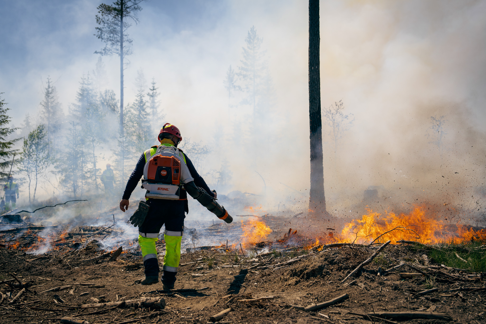
Improving resource sharing in fire and rescue services (BRACE)
Publications
- 53 publications found
Spremic, Mina; Kolstø, Johannes Voll; Aarnes, Ingrid; Arntzen, Alexander Johan and Tanilkan, Sinan. (2026).
Naturfaremodellering for økt beredskapssamarbeid i brann- og redningstjenestene. Vestlandsforskning, Noradapt, Høgskulen på Vestlandet, NORCE, Klimapartnere, KS, Kartverket, Vestland fylkeskommune, Statsforvalteren i Vestland
NVA
Scientific lecture
Show summary
Det er i dag 193 brann- og redningsvesen som dekker den lokale grunnberedskapen i hele Norge. Disse er dimensjonert etter kommunenes risiko- og beredskapsanalyser ved dagens forhold. Samtidig forventes det at klimaendringene vil gi nye utfordringer: lange tørkeperioder kan føre til store og samtidige skogbranner, slik som vi så i tørkesommeren 2018. Våtere og villere klima gir likeledes økende fare for kraftig vind, flom og skred. Å skalere opp hvert enkelt brannvesen til å kunne håndtere et slikt risikobilde vil være kostnadskrevende, og for de mange små kommunale brannvesen en lite hensiktsmessig måte å møte utfordringene på.
BRACE-prosjektet har som hensikt å ta tak i disse utfordringene og utvikle et praktisk, datadrevet rammeverk for samhandling om deling av ressurser ved store og samtidige hendelser. Dette rammeverket skal 1) gi bedre situasjonsforståelse ved å bruke lokale data om risiko, 2) fastsette ressursbehov basert på risiko for mer treffsikker daglig planlegging og 3) sikre en rettferdig og objektiv fordeling av ressurser i krisesituasjoner gjennom kvalitativ analyse av hva som kjennetegner vellykket ressursdeling. I prosjektet har vi valgt å fokusere spesielt på skogbrann og skred.
Her presenterer vi vårt arbeid med å skape en nasjonalt dekkende risikomodell for skogbrann som hensyntar lokale forhold som kan ha betydning for antennelsesfare. Vi tar utgangspunkt i dagens skogbrannfarekart produsert av MET, som igjen bygger på toppen av Canadian Fire Weather Index (FWI) og kan si noe om hvilke værforhold som påvirker skogbrannfaren. Denne modellen kobles så med en database av utrykninger til brann i kategoriene «skog/utmark» og «gress/innmark». Disse historiske hendelsene vil være med på å si noe om betydningen av andre lokale forhold som vegetasjon og befolkningstetthet eller andre datakilder som kan være av betydning for antennelsesfare.
Aarnes, Ingrid and Kolstø, Johannes Voll. (2026).
Skogbrann: Kan data og modeller slukke flammene? Norsk Regnesentral
NVA
Lecture
Aarnes, Ingrid. (2026).
Ressursdeling i brannvesenet ved store og samtidige hendelser (BRACE). Norwegian Space Agency
NVA
Scientific lecture
Aarnes, Ingrid; Scotti, Agustin Arguello; Hauge, Ragnar; Skauvold, Jacob; Eide, Christian Haug and Howell, John Anthony. (2026).
Representing shoreface reservoirs with a rule-based facies model: The GEOPARD algorithm.
Show summary
We introduce a new rule-based algorithm called GEOPARD, which models shoreface deposits by following geological principles. In this algorithm, the outcomes of geological processes are represented as rules that are integrated into the core of a standard geostatistical modeling framework. The GEOPARD builds on the stochastic object-based facies modeling technique and incorporates a Bayesian framework for conditioning to data and reducing uncertainty. This paper outlines the geological prior model of the GEOPARD algorithm, which generates facies geometries and controls object placement using geological rules. Specifically, the algorithm builds up a parasequence by stacking a succession of prograding shoreface bedsets, bounded by small-scale hiatus, until a final point of maximum shoreline advance. Model parametrization closely follows the geological conceptual model. The rules are implemented as a series of fully automated modeling steps, mapping the wide variety of facies geometries typically associated with shallow-marine deposits. The functionality of GEOPARD is demonstrated through a series of scenarios, including the reproduction of features observed in an outcrop analogue and benchmarking against the truncated Gaussian simulation method. Key modeled features include sand-body thickness, lateral extent of facies, overall parasequence geometry, and the spacing and dip of bedset bounding surfaces.
Aarnes, Ingrid and Tanilkan, Sinan. (2026).
Datadrevet felles situasjonsforståelse for ressursdeling i brannvesenet ved kriser. Kartverket
NVA
Scientific lecture
Show summary
BRACE - et praktisk, datadrevet rammeverk for samhandling om deling av ressurser ved store og samtidige hendelser.
Abrahamsen, Petter; Dahle, Pål; Nevjen, Fredrik; Kvernelv, Vegard; Sektnan, Audun; Vazquez, Ariel Almendral; Waade, Bendik Skundberg and Aarnes, Ingrid. (2025).
COHIBA User Manual Version 7.2.1.
Show summary
This user manual describes the COHIBA surface modeling software. It consists of:
Part I Introduction: Basic ideas and terminology
Part II User manual: Usage, input data, and results
Part III Tutorials: Special topics such as volumes, simulation, and faults
Part IV Reference manual: Descriptions of all COHIBA model file elements
Part V Theory: Methods used by COHIBA
Part VI Appendix: Release notes, known issues, references, list of acronyms,
tables and figures, and an index
Abrahamsen, Petter; Dahle, Pål; Nevjen, Fredrik; Kvernelv, Vegard; Sektnan, Audun; Vazquez, Ariel Almendral; Waade, Bendik Skundberg and Aarnes, Ingrid. (2025).
Cohiba User Manual Version 7.2.
Show summary
This user manual describes the COHIBA surface modeling software. It consists of:
Part I Introduction: Basic ideas and terminology
Part II User manual: Usage, input data, and results
Part III Tutorials: Special topics such as volumes, simulation, and faults
Part IV Reference manual: Descriptions of all COHIBA model file elements
Part V Theory: Methods used by COHIBA
Part VI Appendix: Release notes, known issues, references, list of acronyms,
tables and figures, and an inde
Aarnes, Ingrid. (2025).
GEOPARD – Geology-Driven Facies Models. Norwegian Petroleum Society
NVA
Scientific lecture
Scotti, Agustin Arguello; Eide, Christian Haug; Aarnes, Ingrid; Skauvold, Jacob; Hauge, Ragnar and Howell, John Anthony. (2025).
Facies modelling of shoreface subsurface reservoirs with the GEOPARD workflow and comparison to industry standard methods. Norsk Geologisk Forening
NVA
Scientific lecture
Ghione, Federica; Köhler, Andreas; Dichiarante, Anna Maria; Aarnes, Ingrid and Oye, Volker. (2024).
A new approach to estimate Vs30 and depth to bedrock: a case study from the Oslo area (Norway). European Seismological Commission
NVA
Poster
Scotti, Agustin Arguello; Eide, Christian Haug; Aarnes, Ingrid; Hauge, Ragnar; Skauvold, Jacob and Howell, John Anthony. (2024).
Modelling intra-parasequence reservoir heterogeneity with a process-mimicking algorithm: a case study from the Kenilworth Member, Blackhawk Formation.
Aarnes, Ingrid. (2024).
GEOPARD - a geological approach to statistical models. Equinor ASA
NVA
Lecture
Sektnan, Audun; Vazquez, Ariel Almendral; Hauge, Ragnar; Aarnes, Ingrid; Skauvold, Jacob and Vevle, Markus Lund. (2024).
A Tree Representation of Pluri-Gaussian Truncation Rules.
Show summary
Stochastic facies models based on truncated Gaussian random fields are known for being flexible and well suited to reproduce patterns and features from analogues or conceptual models. In pluri-Gaussian simulation, the number of random fields is theoretically unlimited, which adds flexibility and makes it possible to model a wider range of geological settings. However, the truncation map traditionally used to set up these models quickly becomes unclear when used for higher dimensions. Hence, in practical pluri-Gaussian applications, the number of fields is typically kept as low as two or three. We present a formulation of pluri-Gaussian simulation in which the truncation rule, the function that maps combinations of Gaussian random field values to facies categories, is represented as a particular binary tree. This is used to decouple the fields in the critical Gibbs sampling step of the conditioning process in such a way that we can use multiple lower-dimensional samples instead of a single higher-dimensional sample. The resulting conditioning algorithm scales excellently with the amount of conditioning data and the number of fields. The algorithm accepts a combination of trends and probabilities in the same model setup, which provides additional flexibility in representing varying depositional geometries. We demonstrate the hierarchical pluri-Gaussian simulation with two practical examples. One is based on real data from the Volve oil field in the North Sea. The other combines a large number of synthetic observations with a truncation tree tailored to a more complex geological concept. The choices made when building the truncation tree affect the features of the realizations, especially when it comes to which facies can be in contact and which can overprint each other. This aspect of tree building is discussed in light of the numerical examples given.
Aarnes, Ingrid. (2024).
Valhall 5B - uncertainty: Pore volume multipliers for ensemble workflows.
NVA
Report
Aarnes, Ingrid; Hauge, Ragnar; Trier, Øivind Due; Haug, Ola and Vazquez, Ariel Almendral. (2024).
Hierarkisk modell for naturtyper til bruk i naturregnskap.
NVA
Report
Aarnes, Ingrid and Haug, Ola. (2024).
VARSKU - Underground effects associated with flooding, landslide and avalanche risk.
NVA
Report
Aarnes, Ingrid. (2024).
GEOPARD - a geological approach to statistical models. Harbour Energy Norge AS
NVA
Lecture
Aarnes, Ingrid. (2024).
GEOPARD - a geological approach to statistical models. AkerBP ASA
NVA
Lecture
Aarnes, Ingrid; Skauvold, Jacob; Hauge, Ragnar; Vazquez, Ariel Almendral; Lilleborge, Marie and Næss, Solveig. (2024).
GEOPARD 1.0 user manual.
Ovanger, Oscar; Eidsvik, Jo; Skauvold, Jacob; Hauge, Ragnar and Aarnes, Ingrid. (2024).
Addressing Configuration Uncertainty in Well Conditioning for a Rule-Based Model.
Show summary
Rule-based reservoir models incorporate rules that mimic actual sediment deposition processes for accurate representation of geological patterns of sediment accumulation. Bayesian methods combine rule-based reservoir modelling and well data, with geometry and placement rules as part of the prior and well data accounted for by the likelihood. The focus here is on a shallow marine shoreface geometry of ordered sedimentary packages called bedsets. Shoreline advance and sediment build-up are described through progradation and aggradation parameters linked to individual bedset objects. Conditioning on data from non-vertical wells is studied. The emphasis is on the role of ‘configurations’—the order and arrangement of bedsets as observed within well intersections in establishing the coupling between well observations and modelled objects. A conditioning algorithm is presented that explicitly integrates uncertainty about configurations for observed intersections between the well and the bedset surfaces. As data volumes increase and model complexity grows, the proposed conditioning method eventually becomes computationally infeasible. It has significant potential, however, to support the development of more complex models and conditioning methods by serving as a reference for consistency in conditioning.
Aarnes, Ingrid; Scotti, Agustin Arguello; Skauvold, Jacob; Hauge, Ragnar and Eide, Christian Haug. (2023).
Modelling shoreface geometries with a new facies-algorithm informed by geological rules and analogue data. SEPM Society for Sedimentary Geology
NVA
Scientific lecture
Show summary
The main aim of the GEOPARD project is to increase the geological realism of the facies models used in reservoir characterization workflow by integrating geological rules at the core of the statistical modelling framework.
Through the model we define bedset boundaries, capture realistic interfingering patterns between the sand-rich shoreface and the more mud-rich offshore transition zone, and control facies belt thickness and shoreline trajectories. Due to the close relationship between the model parameterization and geological processes, analogue data are utilized to inform the model.
Scotti, Agustin Arguello; Eide, Christian Haug; Aarnes, Ingrid; Skauvold, Jacob; Hauge, Ragnar and Howell, John. (2023).
From Concept to Reservoir Modelling: The Record of Tide-dominated, Progradational Shoreline Systems. INTERNATIONAL ASSOCIATION OF SEDIMENTOLOGISTS; CROATIAN GEOLOGICAL SOCIETY
NVA
Poster
Ghione, Federica; Köhler, Andreas; Dichiarante, Anna Maria; Aarnes, Ingrid and Oye, Volker. (2023).
Vs30 and depth to bedrock estimates from integrating HVSR measurements and geology-slope approach in the Oslo area, Norway.
Show summary
This work shows an alternative and efficient method to estimate Vs30 values and depth to basement data. The Vs30 value is the most important attribute to characterize the soil type and subsequently account for soil type related seismic amplification. We believe that these tools offer a powerful, non-invasive and cost-effective solution for obtaining accurate estimations of depth to basement.
This approach is providing valuable information for seismic hazard assessments, geotechnical investigations and engineering design, as it can help estimate the amplification of ground motions during earthquakes, which is dependent on the soil properties and depth to bedrock. Overall, this study highlights the importance of understanding the geological and geotechnical characteristics of an area in order to accurately assess the seismic hazard and potential impacts of earthquakes. Those results can be used in earthquake hazard models and support decision-making processes related to land use planning, building codes, and emergency preparedness measures in earthquake-prone regions.
Scotti, Agustin Arguello; Aarnes, Ingrid; Skauvold, Jacob; Hauge, Ragnar; Eide, Christian Haug and Howell, John. (2023).
Next generation reservoir modelling algortithms - Shallow marine environments. Norwegian Petroleum Society (NPF)
NVA
Scientific lecture
Scotti, Agustin Arguello; Aarnes, Ingrid; Eide, Christian Haug; Skauvold, Jacob and Hauge, Ragnar. (2023).
Modeling Shoreface Geometries of the Kenilworth Member, Blackhawk Formation, with the Geopard Algorithm. Society for Sedimentary Geology
NVA
Scientific lecture
Scotti, Agustin Arguello; Aarnes, Ingrid; Eide, Christian Haug; Skauvold, Jacob and Hauge, Ragnar. (2022).
Testing a rule-based approach for reservoir modelling of shoreface successions: the GEOPARD algorithm. British Sedimentological Research Group
NVA
Scientific lecture
Aarnes, Ingrid and Hauge, Ragnar. (2022).
Modelling fluvial environments. Winthershall Dea
NVA
Lecture
Ovanger, Oscar; Eidsvik, Jo; Skauvold, Jacob; Hauge, Ragnar and Aarnes, Ingrid. (2022).
A rule-based reservoir stacking model with effective well conditioning. IAMG
NVA
Lecture
Aarnes, Ingrid; Hauge, Ragnar; Scotti, Agustin Arguello and Skauvold, Jacob. (2022).
The Geopard project. Norges Geologiske Forening
NVA
Scientific lecture
Sektnan, Audun; Vazquez, Ariel Almendral; Hauge, Ragnar; Aarnes, Ingrid; Skauvold, Jacob and Vevle, Markus Lund. (2022).
A Tree Representation of Plurigaussian Truncation Rules.
Show summary
Truncated Gaussian fields are a common way of modelling facies, where the correlation structure in the Gaussian field defines a spatial correlation structure for the facies. Plurigaussian simulation takes it further by using several underlying Gaussian fields. This allows more flexibility and makes it possible to model a wider range of geological settings, but conditioning can be difficult.
We present a fast and accurate implementation of conditional plurigaussian simulation. Our approach has two key elements. The first is to combine complex truncation rules with input facies probabilities. The truncation rule, which is a function from the Gaussian fields to a facies value, can be represented neatly as a binary truncation tree. This allows for a general representation that includes all the traditional 2D truncation masks. We show how to combine the use of such trees with facies probabilities, even in complicated cases with more than two Gaussian fields.
The second key element is correct conditioning to all facies observations, not just transitions, by treating them as inequality constraints on the Gaussian fields. We perform inequality Kriging by replacing these facies observations by synthetic observations of the underlying Gaussian fields. To generate synthetic observations that agree with the target posterior distribution, we use a Gibbs sampler. Since this is a quite slow algorithm, we take certain measures to make the calculations faster. Synthetic observations are then used in Kriging, improving the conditioning to facies logs from wells. We demonstrate the method with a synthetic case that combines a large number of observations with the use of a truncation tree tailored from a geological concept.
Scotti, Agustin Arguello; Eide, Christian Haug; Aarnes, Ingrid; Skauvold, Jacob and Hauge, Ragnar. (2022).
Defining the basic rules that describe long-term shoreface dynamics: A process-mimicking approach for reservoir modelling. European Geosciences Union
NVA
Scientific lecture
Kvernelv, Vegard Berg; Aarnes, Ingrid and Abrahamsen, Petter. (2021).
Geostatistisk kartlegging av løsmasser.
NVA
Report
Abrahamsen, Petter; Dahle, Pål; Kvernelv, Vegard Berg; Sektnan, Audun; Vazquez, Ariel Almendral and Aarnes, Ingrid. (2020).
COHIBA User Manual Version 6.1.
NVA
Report
Vazquez, Ariel Almendral; Aarnes, Ingrid and Abrahamsen, Petter. (2019).
Application of NR’s Solutions to Geothermal Reservoir Characterization.
NVA
Report
Aarnes, Ingrid; Vegt, Helena van der; Hauge, Ragnar; Fjellvoll, Bjørn and Nordahl, Kjetil. (2019).
Utilizing sedimentary process-based
models as training images for
multipoint facies simulations.
Show summary
Geostatistical facies modeling algorithms are used in reservoir modeling workflows to create geological models which improve the predictive power of the flow simulation models. In heterogeneous reservoirs, it is of key importance to not only apply statistical techniques, but also incorporate prior geological knowledge. Fluvial dominated deltaic deposits can show a high degree of heterogeneity arising from the interaction of stacking of lobate deposits and the continuous erosion and deposition of the distributary channels while building the delta. To simulate these depositional structures, honouring the physical laws of nature, process-based models can be used to generate synthetic deposits. However, such results are driven by physics and therefore cannot be steered to honour exact well data. We address this challenge by integrating physics-driven process-based models with statistical techniques from MPS. Combining these two different methods is MPS relies on discreet geometric patterns. This is addressed by classifying the process-based model results into discreet facies. A major advantage of this integrated technique is the potential to generate multiple MPS training images through simulation of additional process-based model realizations and we also analyze the effect of using one versus multiple process-based models as input. In this work, we show how the best aspects of both process-based models and MPS modeling can be combined to create improved geological models.
Bárbara, Carla Patricia; Cabello, Patrícia; Bouche, Alexandre; Aarnes, Ingrid; Gordillo, Carlos; Ferrer, Oriol; Roma, Maria and Arbués, Pau. (2019).
Quantifying the impact of the structural uncertainty on the gross rock volume in the Lubina and Montanazo oil fields (Western Mediterranean).
Show summary
Structural uncertainty is a key parameter affecting the accuracy of the information contained in static and dynamic reservoir models. However, quantifying and assessing its real impact on reservoir property distribution, in-place volume estimates and dynamic simulation has always been a challenge. Due to the limitation of the existing workflows and time constraints, the exploration of all potential geological configurations matching the interpreted data has been limited to a small number of scenarios, making the future field development decisions uncertain.
We present a case study in the Lubina and Montanazo mature oil fields (Western Mediterranean) in which the structural uncertainty in the seismic interpretation of faults and horizons has been captured using modern reservoir modeling workflows. We model the fault and horizon uncertainty by means of two workflows: the manually interpreted and the constant uncertainty cases. In the manually interpreted case, the zones of ambiguity in the position of horizons and faults are defined as locally varying envelopes around the best interpretation, whose dimensions mainly vary according to the frequency content of the seismic data, lateral variations of amplitudes along reflectors, and how the reflectors terminate around faults when fault reflections are not present in the seismic image. In the constant case, the envelope dimensions are kept constant for each horizon and each fault. Both faults and horizons are simulated within their respective uncertainty envelopes as provided to the user. In all simulations, conditioning to available well data is ensured. Stochastic simulation was used to obtain 200 realizations for each uncertainty modeling workflow. The realizations were compared in terms of gross rock volumes above the oil–water contact considering three scenarios at the depths of the contact.
The results show that capturing the structural uncertainty in the picking of horizons and faults in seismic data has a relevant impact on the volume estimation. The models predict percentage differences in the mean gross rock volume with respect to best-estimate interpretation up to 7 % higher and 12 % lower (P10 and P90). The manually interpreted uncertainty workflow reports narrower gross rock volume predictions and more consistent results from the simulated structural models than the constant case. This work has also revealed that, for the Lubina and Montanazo fields, the fault uncertainty associated with the major faults that bound the reservoir laterally strongly affects the gross rock volume predicted. The multiple realizations obtained are geologically consistent with the available data, and their differences in geometry and dimensions of the reservoir allow us to improve the understanding of the reservoir structure.
The uncertainty modeling workflows applied are easy to design and allow us to update the models when required. This work demonstrates that knowledge of the data and the sources of uncertainty is important to set up the workflows correctly. Further studies can combine other sources of uncertainty in the modeling process to improve the risk assessment.
Dahle, Pål; Aarnes, Ingrid; Abrahamsen, Petter; Vazquez, Ariel Almendral and Sektnan, Audun. (2019).
Increasing subsurface accuracy with COHIBA by taking advantage of resistivity contrasts.
NVA
Report
Aarnes, Ingrid; Vazquez, Ariel Almendral and Dahle, Pål. (2019).
COHIBA in fault blocks on Valhall.
NVA
Report
Abrahamsen, Petter; Dahle, Pål; Kvernelv, Vegard Berg; Sektnan, Audun; Vazquez, Ariel Almendral and Aarnes, Ingrid. (2019).
COHIBA User Manual Version 6.0.
Show summary
This user manual describes the COHIBA surface modeling software. It consists of:
Part I Introduction: Basic ideas and terminology
Part II User manual: Usage, input data and results
Part III Tutorials: Special topics such as volumes, simulation and faults
Part IV Reference manual: Descriptions of all COHIBA model file elements
Part V Theory: Methods used by COHIBA
Part VI Appendix: Release notes, known issues, references, list of acronyms,
tables and figures, and an index
Advanced topics and technicalities are marked by the warning symbol in the right margin. COHIBA model file elements marked by this warning symbol should be used with some care. The latest version of this document is available at: www.nr.no/COHIBA. For COHIBA support contact Pal.Dahle@nr.no or Ariel.Almendral.Vazque@nr.no.
The following scientists at Norwegian Computing Center has contributed to the development of
COHIBA:
Petter Abrahamsen
Pål Dahle Frode Georgsen
Vera Louise
Hauge Gudmund Hermansen
Odd Kolbjørnsen
Lars Bakke Krogvik
Vegard Berg Kvernelv
Inge Myrseth
Audun Sektnan
Arne Skorstad
Harald Soleng
Ariel Almendral Vazquez
Maria Vigsnes
Ingrid Aarnes
The front page shows two fences along well paths on top of a faulted surface on the Valhall carbonate field in the North Sea. The illustration is made by Ingrid Aarnes. We thank Aker BP for permission to publish the illustration.
Aarnes, Ingrid. (2018).
Traversing the gap from sedimentary process models to facies modeling. CSPG
NVA
Scientific lecture
Vevle, Markus Lund; Aarnes, Ingrid; Ledsaak, Karina; Hauge, Ragnar and Skorstad, Arne. (2018).
Facies modelling of a real-life fluvial system using a modern object-based algorithm. EAGE
NVA
Scientific lecture
Aarnes, Ingrid; Vazquez, Ariel Almendral and Dahle, Pål. (2018).
Valhall structural model with COHIBA.
NVA
Report
Goodwin, Håvard; Aarnes, Ingrid and Hauge, Ragnar. (2018).
Deep marine modelling with RMS on Karoo.
NVA
Report
Aarnes, Ingrid and Hauge, Ragnar. (2017).
Applying Truncated Gaussian Fields to
describe geology. Norsk Statistisk Forening
NVA
Scientific lecture
Aarnes, Ingrid; Fjellvoll, Bjørn and Hauge, Ragnar. (2017).
Utilizing process-based models in facies modelling workflows.
NVA
Report
Stordal, Frode; Svensen, Henrik; Aarnes, Ingrid and Roscher, Marco. (2017).
Global temperature response to century-scale degassing from the Siberian Traps Large igneous province.
Show summary
The Siberian Traps Large igneous province was a key player in the end-Permian extinction and climatic change due to degassing from lavas and heated sedimentary rocks. Although the specific degassing scenarios from the province are debated, this implies that gas release on a timescale tuned to the cooling of lava flows and subvolcanic intrusions (i.e. decades to centuries) must have been sufficient to affect the atmospheric chemistry. Here we test this assumption by using simple box model calculations to constrain century-scale degassing of CO2 and CH4 from high-end volumes of individual lava flows and sills from the Siberian Traps. The model includes gas fluxes of CH4 and CO2, their atmospheric lifetimes and radiative forcing, as well as the climate sensitivity in a global average climate system calibrated to end-Permian time. The fluxes are estimated based on lava degassing and contact aureole volumes and devolatilization during the first 100 years following emplacement. We test the sensitivity to extreme emissions of up to 25 GtC/yr, CH4 fractions from 0 to 100%, wide ranges of climate sensitivities (1.5–6.0 °C for CO2 doubling), pre-event concentrations, and atmospheric lifetimes. We find that the global annual mean temperature perturbation is 7.0 °C in our baseline case using a 10 GtC/yr emission and a 60% CH4 fraction, assuming 4.5 °C as the climate sensitivity. Even for low emission scenarios (0.7–1.2 GtC/yr), the temperature response is ~ 1.5 °C. We conclude that sporadic individual large-scale volcanic events in Large igneous provinces have the potential to cause a strong global warming on very short timescales. In addition to the emission strength, the CH4 fraction and the climate sensitivity have the strongest impact on the century-scale temperature perturbation.
Aarnes, Ingrid; Fjellvoll, Bjørn; Vegt, Helena van der and Nordahl, Kjetil. (2017).
Using sedimentary process models to assist reservoir facies modeling.
NVA
Lecture
Aarnes, Ingrid and Hauge, Ragnar. (2016).
Truncated Gaussian Simulation -
Comparison of methodologies.
NVA
Report
Olsen, Håvard Goodwin; Aarnes, Ingrid and Hauge, Ragnar. (2016).
Panther Tongue Modelling with RMS – Part III.
NVA
Report